HI everybody. Well its been a long time since I posted a Blog update. I've done a few linked YouTube DvD's but no actual blog updates. Soooooo I thought it was time to update all on the latest projects on the UPBNSF Joint Division.
I held the last Ops session on the UPBNSF JD on 22nd May 2021. Then I decided I needed a break from modelling as I had been going hard at it for quiet some time and to be honest my NMRA AR Division 1 commitments were pretty insane at that time.
August came and I was feeling reinvigorated and decided to focus some attention to doing more scenery on the layout. SO I've taken on some scenery projects in the house garage area of the layout as I'm determined to have this area significantly first scenery pass completed by early 2022.
So lets dig in and I'll see if I can't share some of the scenery build processes over each area in the next couple weeks.
PROJECT 1: AYER PROJECT
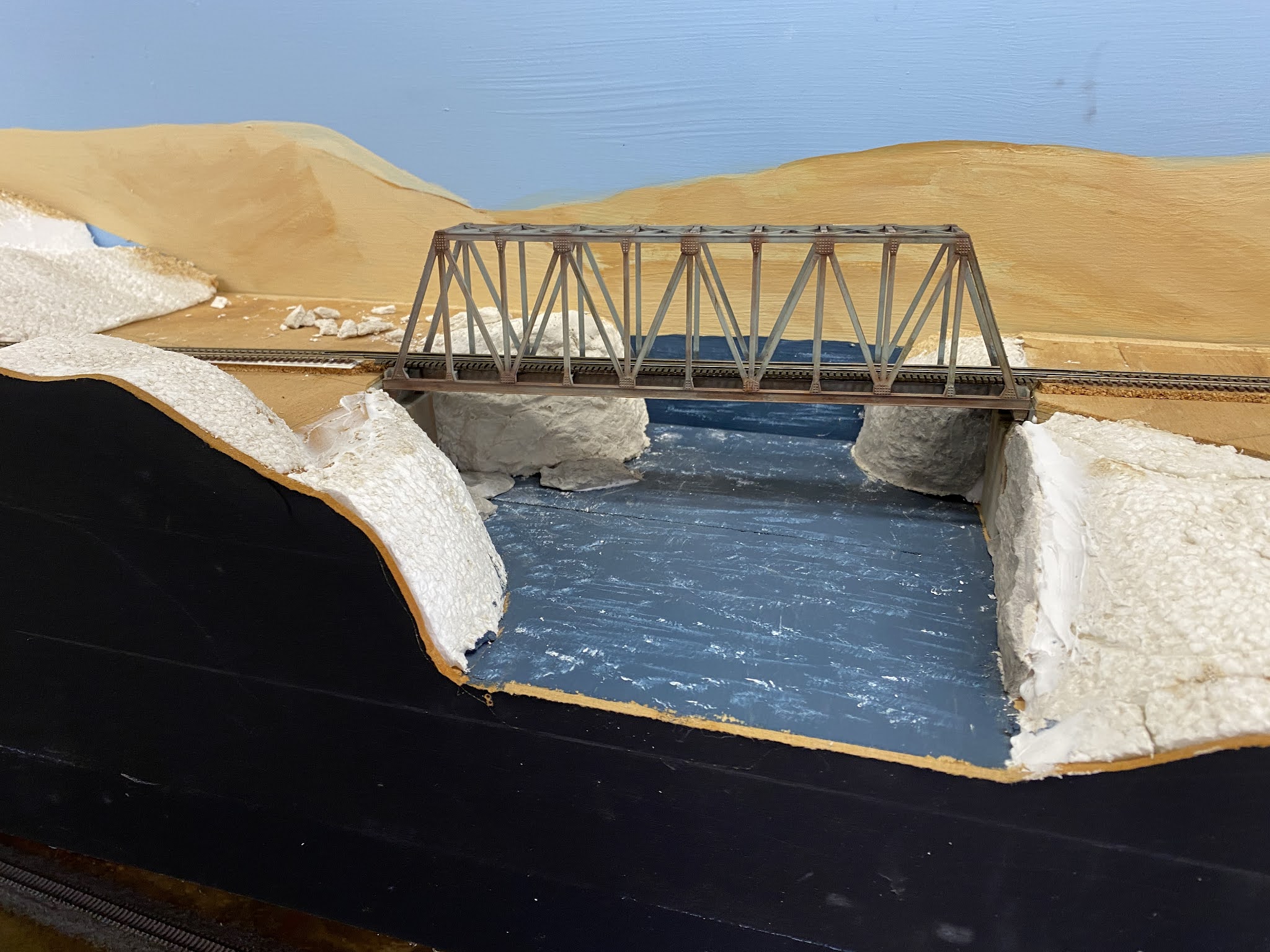
I have a bridge crossing Francis Creek at Ayer (along the Snake River). The bridge is manufactured by Kato. I removed the Kato bridge track and then installed Micro Engineering bridge track and rail. This has a closer tie spacing to the Kato track that comes with the bridge. The closer tie spacing is A typical for a US prototype bridge. After this I added guard rails, to make this scene more prototypical to what I model.
My good mate, Garry Paper then weathered the bridge and track before it was reinstalled onto the layout.
Blending the scenery into the bridge abutments would become an interesting task.

Then the task of fitout of the scenery began. Test fitting the rock moulds for fit and size to the location is all important. The hard bit would be to blend the bridge piers into the surrounding scenery and the acute angles of the river edges.
Moulds with wet plaster were applied to the scene one at a time and slowly I blended the scene into the river embankments and bridge abutments.
Failed moulds were broken up and some fragments were used on the river bed and earthen areas near the rivers edge. These were sprayed with Diluted Indian ink to accentuate the detail before installation.


Rock chips have been used to simulate exposed rock surfaces at ground level
So as it stands right now, the below photos show the current status of the Ayer project to date. The longer term will see apple farms simulated either side of the bridge which is A typical of the location represented.


OK good job. Glad to see you are back at it!
ReplyDelete